Designers in Residence
Designregio Kortrijk
2020-2021
Kortrijk’s eiland(s),
a cultural landscape
Our research started in-between time. We were invited by Designregio to think about the future of urban leisure. In this context, we quickly compiled a set of maps that dig deep in the far past of Kortrijk.Suddenly, the present revealed the link. As we visited Wildebras︎︎, we learned that a moated farmstead used to stand where the self-run, parent-free adventure park is now.
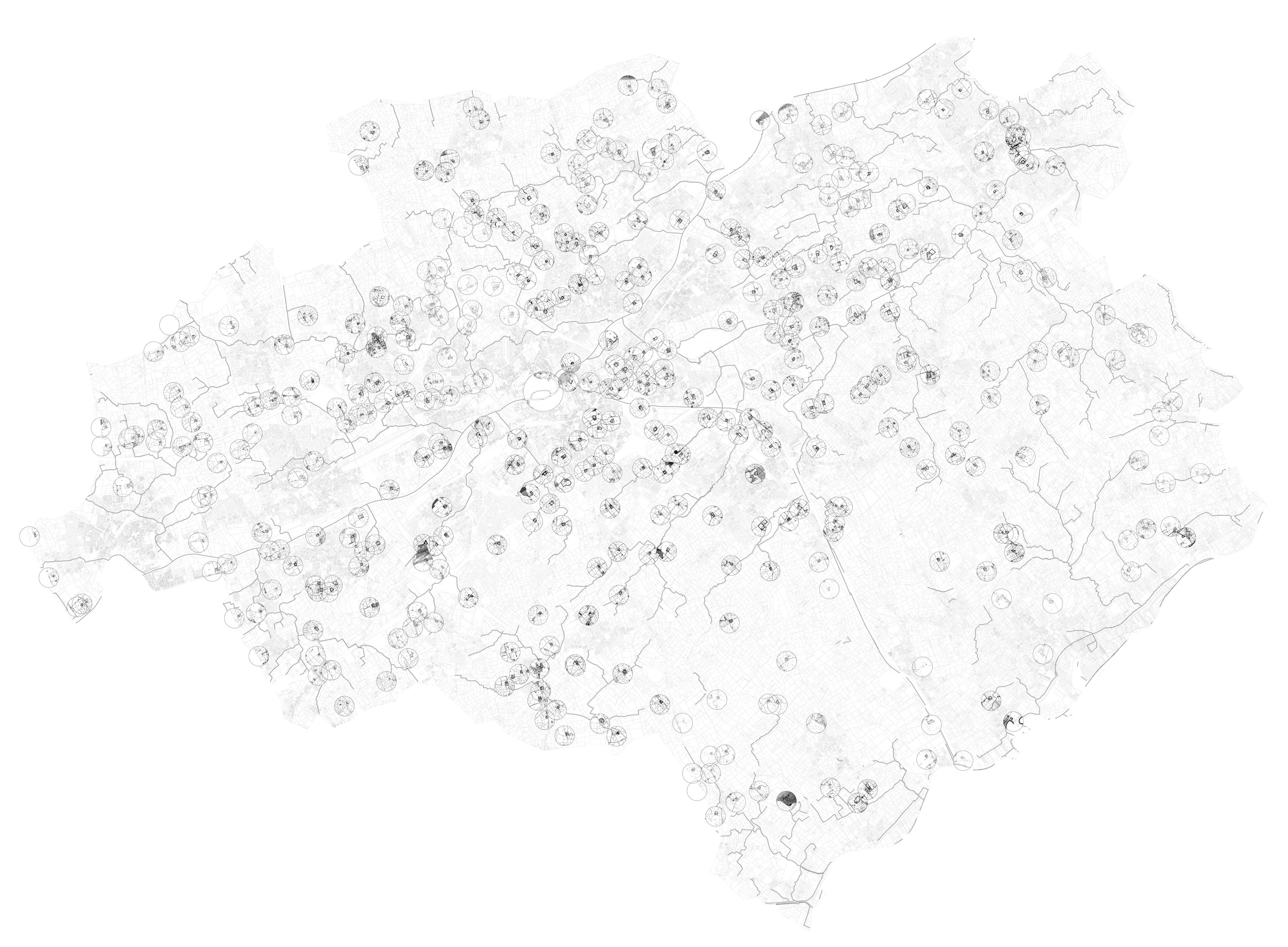
We then found similar spaces throughout the city.
Are historic Islands the future of Kortrijk?
We then found similar spaces throughout the city.
Are historic Islands the future of Kortrijk?
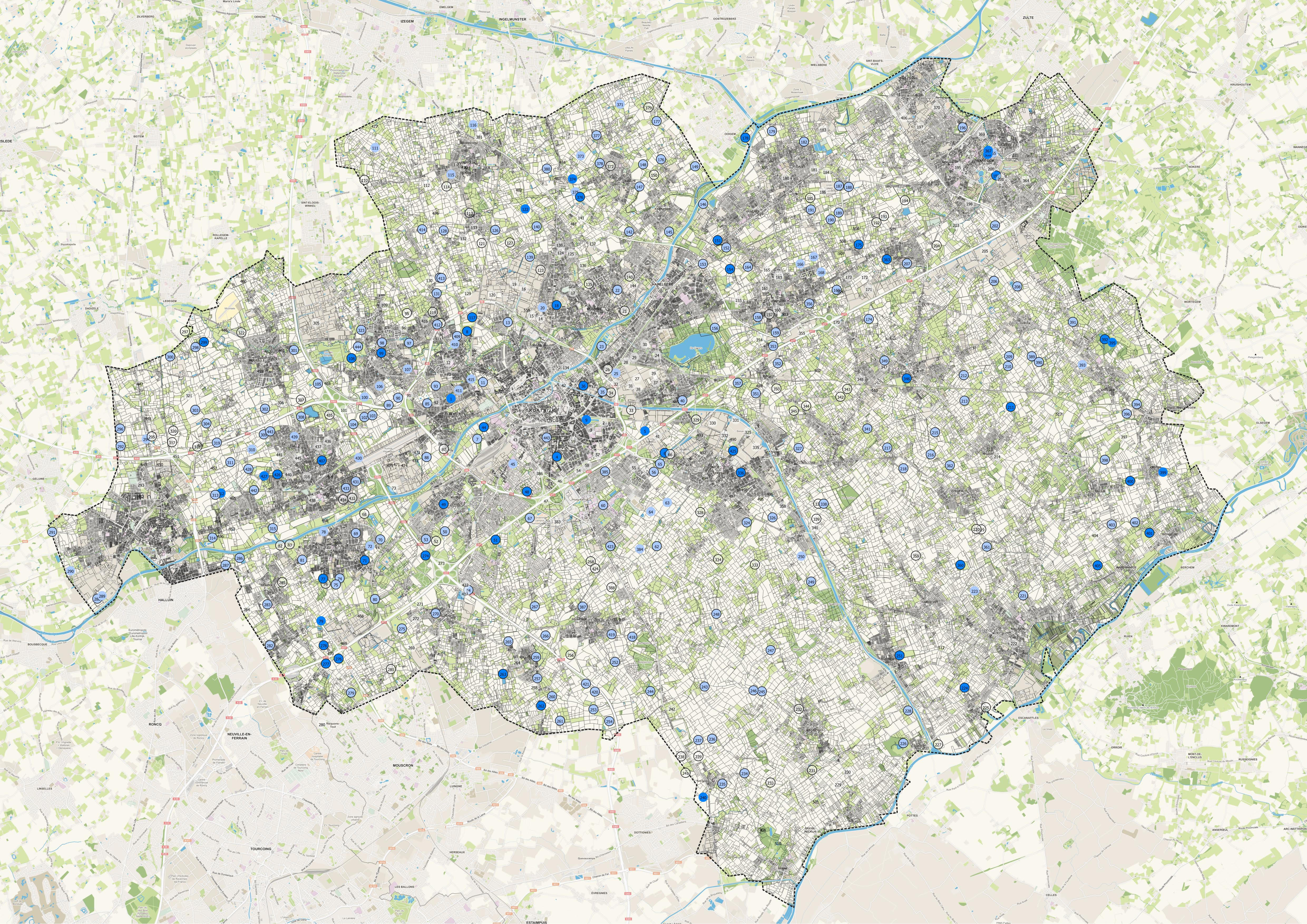
In the mid-19th century Kortrijk countryside was filled with moated homesteads, many of which were farms.
Around 1850 we identified some 500 of them, at an average distance of 1.5 km away from each other. That results in a density of about one moated farming settlement per square kilometer in Kortrijk’s region.
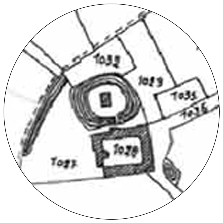
The ‘inland’ varies in size and can be relatively big so as to accommodate several parcels, or particularly small containing only one building.
Around 1850 we identified some 500 of them, at an average distance of 1.5 km away from each other. That results in a density of about one moated farming settlement per square kilometer in Kortrijk’s region.
The ‘inland’ varies in size and can be relatively big so as to accommodate several parcels, or particularly small containing only one building.
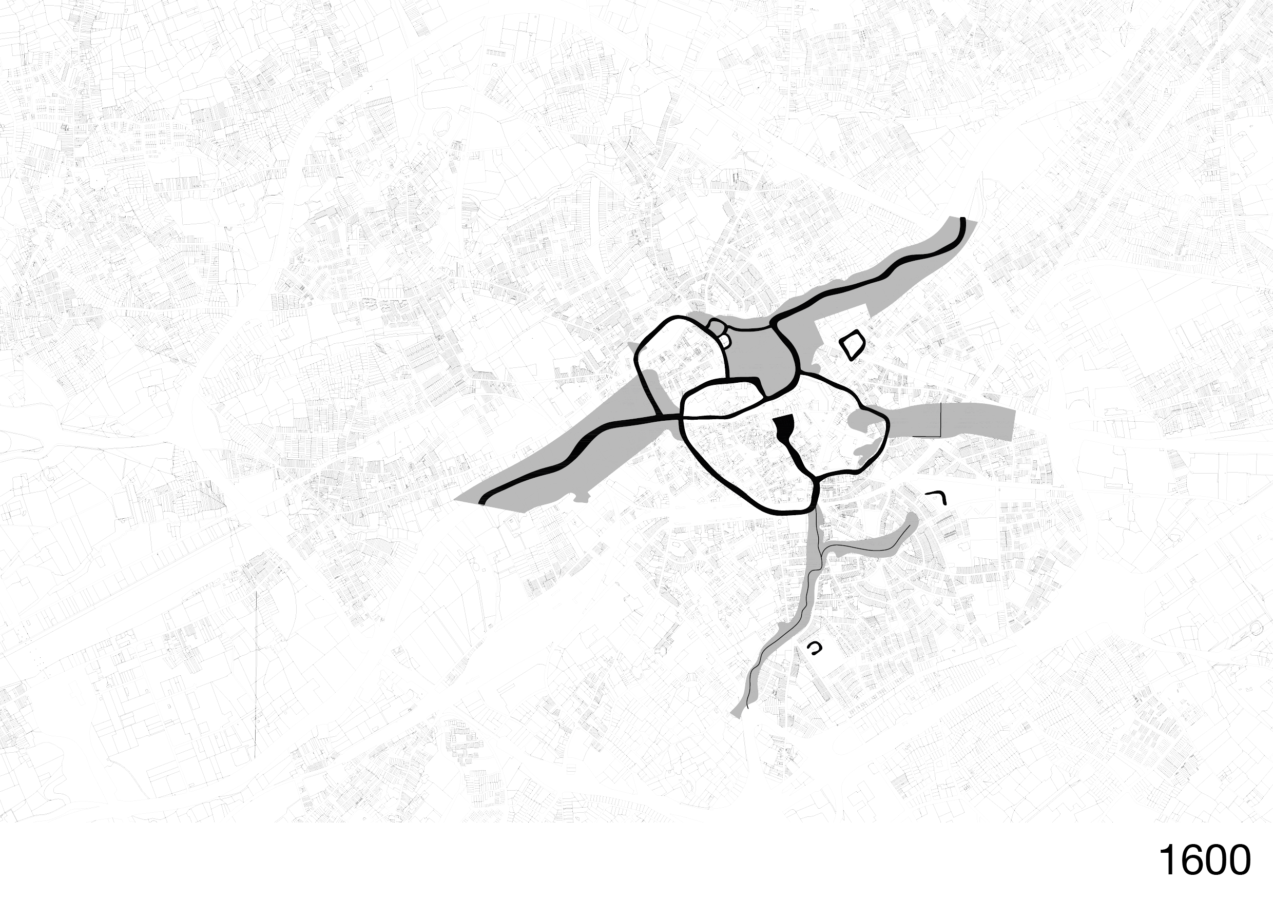
Around 1600, Kortrijk itself was composed of several fortified islands.
The shaping of the watersystem keeps being an on-going project.
Ever since medieval times, farms in Kortrijk constructed moats around them that served social and defensive purposes; keeping out unwanted visitors and expressing the social status of the farmstead. The water was also used for production purposes.
Transformation of Kortrijk’s waterscape through time [XVIe Century - today]
v
v
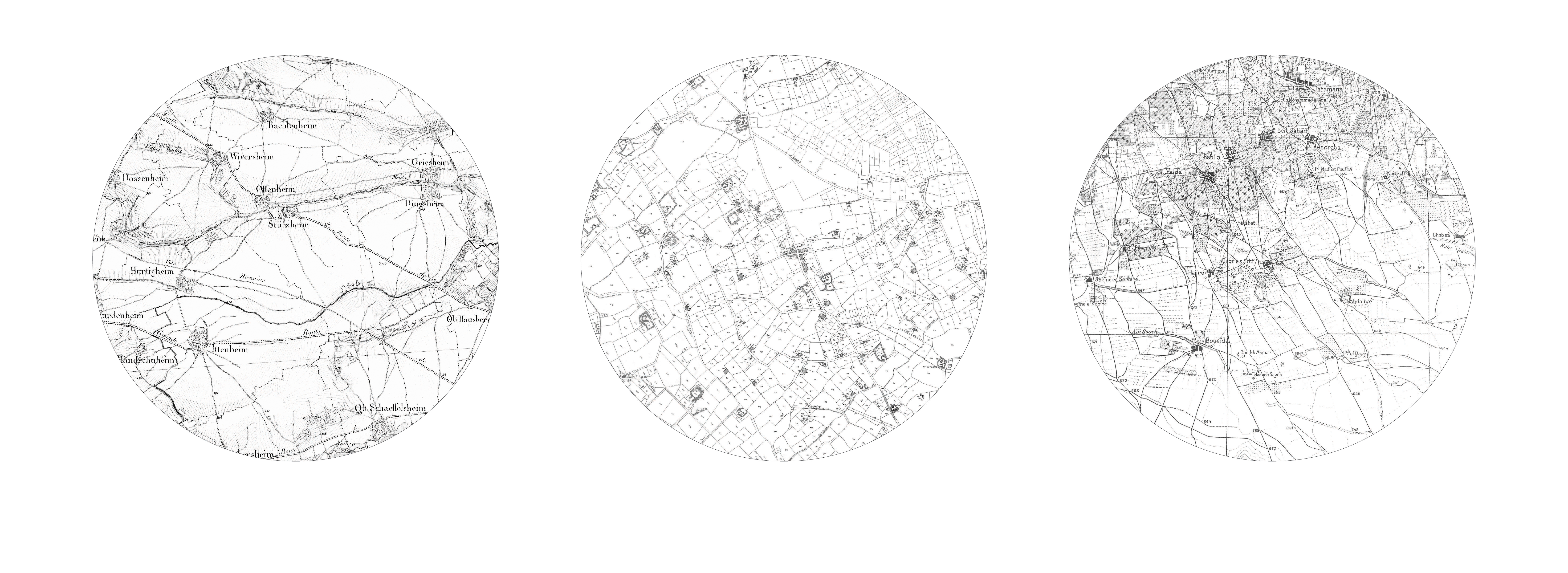
Sample analysis of agricultural landscapes
[village-centered, individual farming, collective cultures]
v
This spread-out individual farming system seems to be a particularity for the west Flemish region and is translated through particular spatial, social and economic practices in the countryside.
Many of these moated homesteads since disappeared with the creation of big infrastructures [railway, highway] or the urbanization of large mono-programmatic areas [all-residential, all-industrial].
Today, though, we can still discover old islands hidden all around.